Once in a while we hear about an adventurous soul who has set out on a bicycle without any route in mind, and wriggled a route across some scenic part of the map. It’s rarer to do this on foot, for at least two reasons, first: pedestrians move slowly and cannot carry very much, so careful planning is required to ensure one has enough food until the next settlement, and second: walking on roads isn’t very fun, so routes are limited to undeveloped areas which are not always connected. Longer walks usually make use of existing long-distance paths, which are becoming more common thanks to projects such as the Transcaucasian Trail.
However, in some countries, such as Ecuador, long-distance trails do not exist yet, and a hiker wishing to traverse the country must improvise their route. Even in places where long trails do exist, there is an appealing freedom to devising new ones. Notable British hiker Alfred Wainwright invented his “Coast to Coast” route to inspire “originality and initiative”, although ironically the route has now become a National Trail in the UK. Since his time, it is has become even easier to plan a route: when using mapping apps, it is not even necessary to plan the trip in advance; each section can be improvised just a few days before.
I liked the idea of doing a freestyle hike like this across Ecuador. One reason is that I was not organised enough to plan a route in advance of my trip. However, I also liked the idea of being free to go wherever I felt like, in the wake of the restrictive covid pandemic.
Map of hiking route. Click and drag the black square in the full-size image to move the zoom window.
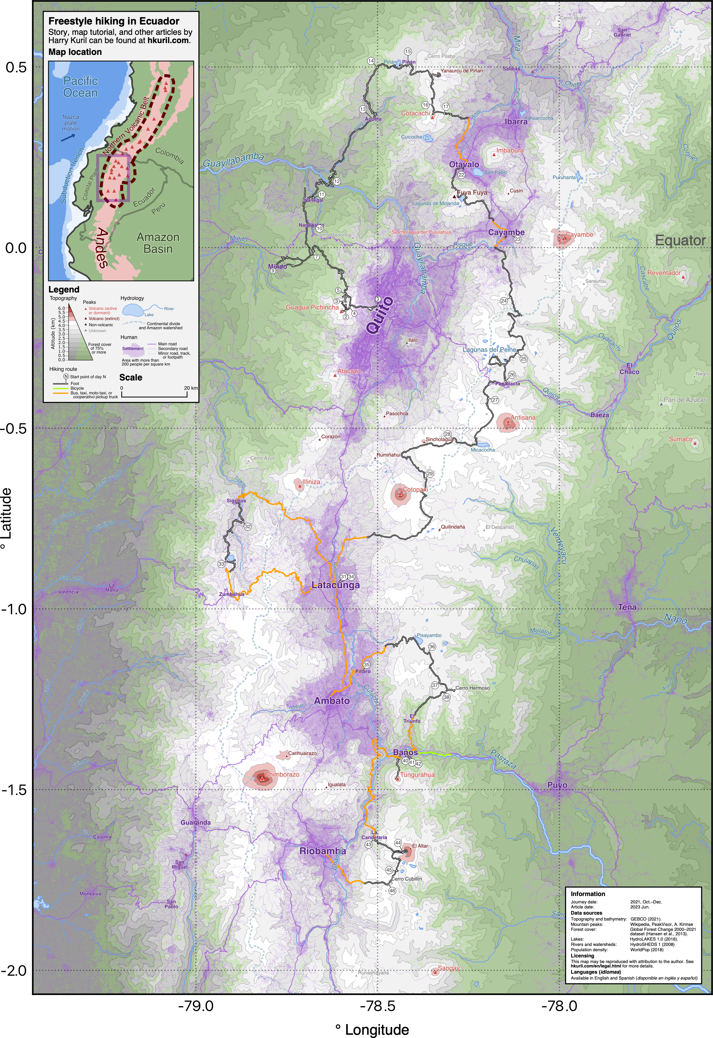
I found the freedom I was craving. The most suitable hiking terrain is found in the highlands, where the landscape is mostly a soggy moorland called páramo, across which one can walk in any direction. It reminded me of Scotland until the fog lifted and I saw hummingbirds, volcanic peaks and tapir footprints. I weaved my path southwards through the Alley of the Volcanoes, whose peaks each had a different character, from Tungurahua's “throat of fire” to the cold crown of El Altar. Ironically, my freestyle hike made me think it would be wonderful for Ecuador to have a long-distance trail down its spine.