Article: The best places to see the Northern Lights
I made maps to plan a trip to see the aurora borealis. See the maps in the blog post and read about how it went!
Mar. ‘25
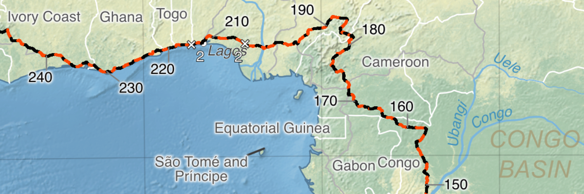
Article: Map and analysis of Russ Cook’s “Project Africa”
Visualise Hardest Geezer’s amazing run between Africa’s southern and northern limits in my new blog post.
Dec. ‘24
Article: My top 10 cartography websites (and a comprehensive list)
If you love maps, make sure to go through this list of my 10 favourite cartography websites, plus almost 100 more worthy sites. You’ll see inspirational work from modern cartographers, such as the example here, an illuminated world map by Evan Applegate.
Nov. ‘24
Article: How to walk the Transcaucasian Trail
Take a look at my Guide to hiking the TCT, including an interactive map as well as tips on gear, weather, expenses, safety, and sections.
Feb. ‘24
I hiked the Transcaucasian Trail
I walked the whole TCT from Meghri (Armenia) to Anaklia (Georgia). Thanks to those who encouraged me and followed my Live tracker.
Aug. ‘23
First travel story and map: Ecuador
I wrote a short reflection on my hiking trip following Ecuador’s Avenue of the Volcanoes. It contains a map designed to emphasise the key details of Ecuador’s landscape.
Jun. ‘23
First article: Making beautiful contour maps
I wrote a guide to making filled contour maps using free software. My first article was the culmination of a long period spent learning how to build a website.
Jun. ‘23