The route of the Transcaucasian Trail

Start date of trip: 15th June 2023. Article publication date: 11th February 2024.

Contents

An interactive map of the Transcaucasian Trail north-south route
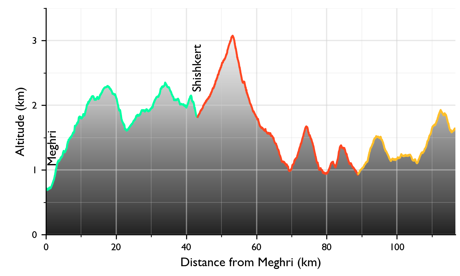
Meghri to Shishkert

Elevation profile
Description
Image in overlay

Hover the mouse over a section to see its elevation profile.

The Transcaucasian Trail is actually two hiking routes in the Caucasus region. The East-West Route joins the Black Sea and the Caspian Sea via Georgia and Azerbaijan, but it currently only exists in fragments. In contrast, the North-South Route was declared open to through-hikers in 2023. This route joins the Greater and Lesser Caucasus mountain ranges through Armenia and Georgia. It is shown in the map above.

The map is intended to give a feel for the route. I divided it into sections, which are shown as alternating red and orange lines. Hover the mouse over any section to show an elevation profile and description in the side panel. The shading of the background map shows elevation above sea level, with lighter colours being higher.

Choosing which TCT sections to hike

Not everybody has the time, resources, or inclination to hike the entire TCT. The trail is also a great framework for shorter hikes. In the next sections, you can read about the differences between Armenia and Georgia, and hints for choosing shorter sections for hiking.

Hiking in Armenia or Georgia?

There are many differences between Armenia and Georgia which are noticeable from a hiker’s perspective. The TCT project is less advanced in Georgia, with some sections likely to change significantly in the coming years. Armenia has a higher proportion of smooth, open landscapes more suitable to herding, whilst Georgia is more crinkled and forested. The Armenian section passes more monasteries and other historic sites, and encounters with rural people were more common for me. In contrast, it seems that the Georgian TCT prioritises solitude where possible. Georgia is wealthier, so it has more cars, more paved roads, and more fences. The people of both countries are very hospitable, but Georgia is the land of wine and in Armenia I mostly was offered vodka (oghi).

Which TCT sections are the best for...?

Varied landscapes
The TCT has very varied landscapes, passing from arid canyons to snowy volcanic calderas. Even some of the shorter sections pack in a lot of variety. Sections 22 and 23 go from the volcanoes, lakes and pastures of Armenian Plateau (though here part of Georgia) down into its rugged forested foothills. The steep Tobavarchkhili Traverse (34) has major elevation changes which pass through many biomes. The Debed Canyon around Tumanyan and Alaverdi (17 and north part of 16) has caves and forests nestled into its walls, old towns on its edges, a deep river, and a long ridge overlooking it; a loop is possible. The short section from Meghri to Shgharjik (1) crosses from arid, spiny mountains into ancient oak forests in a single day, followed by the impressive limestone of Mount Khustup and then more deep forests with monasteries.
Experiences unique to the Caucasus
A photograph of the caldera lake of Mount Azhdahak, with the snowy rim reflected in still water with stepping stones. A unique part of the TCT is the traverse of the Gegham volcanic field, which culminates on Mount Azhdahak’s snowy caldera. . It’s difficult to distil what’s unique about a region. The unique features of the Caucasus pervade the TCT, such as the hospitality and the living history (for example the monasteries and Svan towers). However, most hikers find the Gegham Traverse (14) very memorable, with big blocks of obsidian scattered over volcanic grasslands, red rock, an ice-rimmed caldera, and the intensely hospitable summer nomads who invite hikers to eat and sleep in their house-tents.
Monasteries and other historic sites
The Armenian half of TCT hits more historic sites than the Georgian one, although the villages of the Greater Caucasus have many well-preserved towers. Nearly all Armenian sections will pass at least some ancient monasteries, often still in use after a millenium. Some of the most remarkable are the Tatev Monastery and its ruined hermitage (4), and Noravank (11). From Yeghegnazdor you can follow the TCT to the Selim Caravanserai and pass Spitakavor monastery along the way (12 and 13).
Well-established hiking infrastructure
Some sections of the TCT are firmly-established hiking destinations. They are suitable for those who prefer to sleep and eat in a guest house, or don’t want to worry too much about navigation. Thanks to the efforts of the TCT Association, the Mestia–Ushguli trek (31) is now world-famous. It can even be a little bit busy. The other options are still quiet and little-known. These include the area to the west of Mestia (32), and, in Armenia, southern Vayots Dzor (9) and the area around Dilijan National Park (parts of 15 and 16).
Connections to other trails
Hiking is only becoming popular in the Caucasus thanks to the efforts of the TCT Association and their partner organisations, and the trail network is still growing. From Tatev monastery (4) you can branch off along the north part of the Legends Trail. The National Parks of Dilijan (parts of 15 and 16) and Borjomi-Kharagauli (24) have more extensive trail networks.
Wilderness and nature
Pockets of wilderness survive in the more rugged parts of the Caucasus, for example along the Zeskho bushwhack (29) and between Meghri and Shishkert (first part of 1). Elsewhere, you still have a chance of seeing bears, bezoar goats, or other wild beasts.
Dramatic mountains
Where the TCT follows the Greater Caucasus (sections 29, 30, 31, 32 and 33) there are abundant views of grand, glaciated sierras.
Alpine lakes
A photograph of (Lake) Tobavarchkhili taken from the north shore looking south towards a mountainous rim, with purple wildflowers in the foreground. Tobavarchkhili is a beautiful lake for swimming, albeit a little cold! . Refreshing swims and beautiful reflections can be found in Tobavarchkhili and its neighbouring lakes (34) and in the Samsari Range (22).
Grand canyons
Armenia abounds with canyons, which are often cut deep into columnar basalt, displaying amazing hexagonal shapes. The most amazing are the Debed Canyon in the Tumanyan and Alaverdi (17 and north part of 16), the Vorotan Gorge around Tatev (4), and the red-rocked Amaghu Gorge (11).
Glorious forests
The crinkled foothills of the Caucasus preserve impressive groves of old-growth beech forests, especially in the Borjomi-Kharagauli National Park (24, Dilijan National Park (parts of 15 and 16), and near the King Tamar cliffs (south part of 27).
Meeting summer nomads
The nomads who graze their flocks in the Caucasian Highlands are some of the most hospitable people in the world (although their dogs are a different matter). Their largest summer territories along the TCT are the Gegham Highlands (14) and around the Samsari Range (22).
Seeing day-to-day rural life in the Caucasus
A few sections of the TCT pass through more densely settled rural areas (35, 26 and 24), where the rural patterns of life are easy to observe, and friendly encounters are common.
Quirky sights
A photograph of a hail cannon, which is a small metal shed with a tall, upward-facing metal cone. A hail cannon, one of the quirky sights at the northern end of the Armenian TCT . Between Stepanavan and Lake Arpi (sections 19 and 20), the TCT passes an arboretum, a large lily pond, neolithic standing stones, and agricultural hail cannons. Section 5 takes in hot springs, igneous rock formations, and ancient bridges and tombs.
Ridge walks
Section 27 includes a spectacular ridge walk, culminating in the King Tamar Cliffs. Other good ridge sections can be found between Sevan and Alaverdi (15 and 16).
A less steep walk
Use the elevation profiles in the map to gauge steepness. The highlands of Central Armenia are generally less steep than elsewhere on the TCT. Between Harzhis and Gorayk is a gentle, pleasant walk (5 and 6).
A challenge
The Gegham Traverse (14) is often considered the most testing section of the TCT due to the lack of resupply options, but the slopes are gentle and open. Steeper, more overgrown sections are probably more challenging: the hot, dry first two days out of Meghri (1), the wild Zeskho bushwhack (29), and the Tobavarchkhili Traverse which has steep slopes, vegetation, and mud (34). Another way to find extra challenge would be to attempt part of the TCT outside the peak season. The winter conditions are particularly formidable!

Route metrics

Distance and elevation

Some measurements of the Transcaucasian Trail are shown in the table below:

Distance Elev. change (m)
km mi Ascent
Descent
Armenia 860 534 32,164 30,813
Georgia
705 438 26,931 29,078
TCT total 1,565 972 59,095 59,891

Note: Total ascent and descent are difficult to estimate. Small wobbles in the elevation profile can artificially increase these figures by 50% or more (in both GPS recordings and altitude estimates from digital elevation models). For a good explanation, see here. The elevation profiles shown here are interpolated from the SRTM 1-arc-second dataset. The total ascent and descent are calculated from these profiles by filtering with a 10-m threshold.

Close approaches to other territories

The TCT passes close to these regions:

Region Distance (km)
Iran 1.8
Azerbaijan
(except Nakhchivan)
3.0
Nakhchivan 2.1
Turkey 15.4
South Ossetia 2.9
Abkhazia 1.8
Russia 3.0